Sunday, May 25, 2014

2014 Memorial Day Ride

Sunday morning, 6:45 a.m., time to get up and get dressed for another memorable Veterans Memorial Day Ride.  Fed and watered the dog (Mr. Amadeus), gave him a pat on the head and a treat, went into the garage and donned my riding clothes.  It was cool this morning so I put on the chaps w/o the insulated liners, put my rain liner in my summer riding jacket, winter gloves and the helmet.  Pushed Sweet Thang out of the garage, closed the garage door and fired her off.  Aah, such a sweet sound so early in the morning.  No, she's not loud like one of those Harley's, but a nice deep purr like stroking a big cat.

Out of the subdivision and onto Boyds Creek Highway to Chapman (U.S. 441) heading for Sevierville, TN.  It was very little traffic this early so I just kicked her up a notch and cruised into Sevierville.  Right turned at the junction of TN 66, rode a block and left turned into the courthouse area where the ceremonies and ride would begin.  There was already half a dozen bikes parked up front already.  I like getting there early and up front but by the time the host and his friends, the flag bearers and a few others pull ahead, I'm about No. 35 from the front.  But still better than being in the middle or back.


Sweet Thang is in the middle of the top left picture.  Shortly afterward the other bikes showed up and kept coming in until there was over 2500 motorcycles parked along the streets and parking lots around the courthouse.  Now take a quick stab at your math and figure if all of them averaged a value of $15,000, which is way on the conservative side, how much money was parked in downtown Sevierville today.
Now I wasn't great in math but my calculations makes it come out to approximately $37, 500,000 worth of bikes, not counting all the leather and riding outfits.  Why there must have been two tons of chains, some that could be used for tying down a load of logs, walking around.

Some opening ceremonies were conducted and then my favorite guest was shown, Mr. Lincoln, a great bald eagle that had been rehabilitated at the Eagle Rehab Center, but when turned back into the wilds, kept coming back to the Center.  So they just keep him there now and show him to the school kids and other people interested in animal rehabilitation.

Each branch of the military is recognized, a prayer is given by a Chaplin, and some speeches along with a few songs.  But Mr. Lincoln takes center stage.  He is a majestic bird and a fitting symbol of our country.

Memorial Day is not for a three day weekend but for honoring those that died defending our country.  It was a great day, overcast, not too hot, and with a somber feeling at times as most men and women there had lost family, loved ones or friends.


After the ceremonies was over, it was time to head for the bikes and saddle up for the 65 mile ride from Sevierville to the top of Clinch Mountain where the Veterans Monument Overlook is located.  At the overlook a placing of a wreath takes place and a 21 gun salute along with the folding of the flag with each of the thirteen steps read as to their meaning.


This is a police escorted ride with law enforcement from several counties and several towns along the route working together to block off roadways.  The ride starts rolling and doesn't stop until we reach the overlook.  People pull over onto the sides of the highways, set their lawn chairs along the route and in their yards waving their flags and showing banners honoring the cause.  Really touches your heart and makes you have a little more faith in your fellowman.


Along the route a fire truck had a suspended American Flag over the lane the bikes were riding in.  We rode staggered in a single lane and stretched 8 miles.  At the overlook the bikes were packed into the parking lot and along the sides of the highway near the entrance area.  To the left is a bike passing in front of the Color Guard at the overlook.
The overlook is very scenic, overlooking Cherokee Lake below.  There are several religious organizations handing out cold bottles of water and offering assistance to anyone needing it.  Amazingly, there were no wrecks and to my knowledge there haven't been the five years I've ridden with this group.


After the ceremonies were over I waited until a hole opened up to get out of the parking lot and headed up the hill to a little restaurant which I call the Vinegar Pie Place.  It is known around the area for a vinegar pie which tastes a lot like a lemon pie, rather tart.  They do make a really good hamburger.  After chowing down I took off on an alternate route back to the house.  The highway, U.S.25E is a great road with nice scenery.


 West slope of Clinch Mountain.                                     A Tennessee Rock Farm.

Scenes along the route back to Seymour.


The clouds got heavier and i rode a little faster trying to beat the rain.  The scenery was nice as I passed a couple of rock farms, a few fixer-uppers, and rode through some small villages.  Just as I got back into Knoxville, I got caught by the rain and wouldn't have gotten wet except a signal light caught me.  A few minutes later I was out of the rain and stopping to gas up the bike.  Arrived at the house around 4:30 p.m.

All total, 152 miles and a good time with a lot of "Old Military Folks".  How was your Memorial Day Weekend?


Saturday, May 17, 2014

Once Again

Darned if I didn't go and do it again.  I recharged my camera battery and went off leaving it on the dresser.  Going to need an "Ole Timer's Checklist".  I decided to take the day off from working on the deck.  So I left the house this morning around 8:30, rode up to the local McD's to have coffee with "The Elderlies".  Then left there after an hour and rode over to Sevierville to get a haircut.  After the haircut and a bit of listening to the barber's BS, I rode the back roads to Cosby, TN.  It was in the upper 50s when I left and damp with a cool breeze blowing.  Made it feel more like in the 40s.

Skirted Pigeon Forge and Gatlinburg by riding the back roads.  Really pretty and green with the rains we've been having lately.  And I love those twisting back roads when they're dry.  Finally arrived at US 321 that goes from Gatlinburg to Cosby (known for it's part in making Moonshine).  Hung a right onto TN 32 and rode a couple of miles to the park entrance.  This is the last drive-to campground in the Smoky Mtn. National Park on the upper TN side of the park.  They were having a local festival of sorts, telling about making moonshine in the old days, as if it's really stopped, making quilts, some artisans with their wares, etc.

After a cup of coffee and looking around I loaded my buns back onto Sweet Thang and we headed back via the main road to Gatlinburg.  Then over to Pigeon Forge where I met an on-coming biker (with female passenger) riding one of the longest bikes I've ever seen.  And me with no camera.  It was a custom built black trike running two large V-8 engines, one stacked behind the other.

Then a little further up the road I saw a man on a blue trike and a woman on a yellow one, both sportly painted with lots of pinstripes.  Each trike had a big chrome 427 V-8 engine with a hot cam.  Some people just have money.  I always contribute it to selling drugs cause I worked my butt off for 42 years and couldn't afford one of those without emptying the savings totally.

I pulled into the County Courthouse area where the Blues and BBQ festival was being held.  This is an annual event with BBQ cook off contest, lots of Bluegrass music and plenty of various vendors.  Grabbed a pulled pork sandwich from the Governor's Winners group, then waddled back up the street to the Funnel Cake vendor, had to purchase one of those, and then high tailed it back to the house to enjoy with a cup of hot coffee.

Only rode about 100 miles but it was rather refreshing after a week of working.

To all, ride safe, enjoy life.

Sunday, May 11, 2014

Ride To Hiawassee And Ducktown

This ride doesn't have any pictures because I went off and left my camera at the house.  Got too busy fixing stuff for the dog before I made my early departure from the house.  Not the dog's fault, just my lack of thinking.  I tried using some pics from my rider friend but they kept tripping out the blog.  So you'll have to use your imagination on this one.

I've been working my butt off on replacing the deck (Patio to you flatland folks) which is about 2 ft. off the ground on the East end and 4 ft. on the West end.  Anyway, I decided that I needed some R & R.  So late Tuesday afternoon I called my biker friend Paul to see if he was riding Thursday and the answer was yes but he didn't know where to.  I told him I didn't care where, just what time and where did he want to meet up.  Wednesday evening I received an email saying to meet at our local Micky D's at 7:45.  And that I did.

Our trip was going to take us down in South TN to a place called Hiawassee River Overlook.  This is Northeast of Chattanooga and East of Cleveland.  The Hiawassee River has a lot of canoeing, kayaking, rafting, fishing, etc.  At this time the water is very low and we saw only one fly fisherman.  After viewing the river we stopped at Reliance, TN at the local convenience store, gas station, deli, tackle shop, fishing permit, Saturday night hang out and Business Stuff outlet.  A lot of BS conversations according to the three benches out front of the store under the canopy.  Great folks and a cheap cup of coffee, at $0.50 per cup.

We left Reliance and headed for Ducktown, TN or as some people refer to it as Copper Hill.  Back in the mid 1800s a man prospecting for gold found a lode of copper instead and before you know it there were 16 copper mines.  This went on until in the early 1950s and then everything dried up.  The place was a mess, all eroded and treeless as they were cut to make charcoal for fuel for the steam boilers and what trees that were left were killed by the acid run-off from the smelters.  My first time there was May of 1960.  It was just an eroded mess with a few scrawny trees and a lot of red dirt.  Today it has been replanted in trees.  One of the mines caved in leaving a large hole with a small lake in it.  There's also a small museum there with a lot of pictures of its busy time and some old mining machinery.

From Ducktown we rode North toward Coker Creek.  We made a little side trip to a place called "Fields Of The Wood" which is owned and operated by the Church of God.  It is a tranquil place nestled in the valley between two large hills.  On one hillside are the Ten Commandments spelled out and on the opposite side of the valley are the Psalms of Praise.  There's also a hill referred to as the Flags of Nations with flags from numerous countries flying.  I suppose this represents the countries where they have churches or missionaries.  There's a replica of The Tomb along with a baptism pool, a deli and a gift shop.  A nice quiet place to visit and ponder on your thoughts.

We rolled on through Coker Creek by-passing most towns and came back into Tellico Plains where we had stopped that morning for gas and a coffee.  There we met two riders from Montreal, Quebec Canada.  We gave them some riding tips on their trip back up the Blue Ridge Parkway and then we headed out.  Still on the backroads passing old buildings, large farms, big barns and finally the lake near Vanore.  From there we scooted on to Seymour where we stopped at the White Star Market near my house to grab a soft freeze ice cream to cool down.  It was in the upper 80s in the shade and a lot warmer in the sun.

We had a great day of riding.  Meeting new people, seeing new things and enjoying a restful day while clocking in 250 miles for the day.  Now back to the deck.  UGH.

Next time there will be pictures.  So ride safe, enjoy life and have fun.


Monday, May 5, 2014

Ride To The Top

Ride To The Top

It was such a beautiful wintry afternoon to stay put inside of the house so I donned my winter riding gear and cranked up Sweet Thang (that's what I call my bike) and headed out from Seymour, TN where I live to the top of the mountain where TN and NC meet up.  This location is Newfound Gap, the highest point where U.S. 441 crosses the Appalachian Mountains from Gatlinburg, TN to Cherokee, NC.  The most difficult part of the trip is getting through Pigeon Forge and Gatlinburg.  Seems all of the tourists were out to enjoy the day also.

Once we left Gatlinburg we hit the edge of the Smoky Mountain National Park boundary.  The flashing sign along side of the road cautioned of ice and snow on the roadway.  Well, it had warmed up after the big snow fall so I felt pretty safe with most of the road that was in the sun.  However, on the shady side of the mountain there could still be some ice.  And there was ice, in several spots but the Park had put some finely crushed limestone on it for traction.  They don't use salt on the roads in the Park for environmental reasons.

There was still plenty of snow along the sides of the highway, especially where the sun was not hitting it.  It made everything softer to the look and the gray tree trunks showed like match sticks along the way.  Riding a motorcycle allows a much better look at nature than inside the cab of a vehicle.  And with the feel of the crisp air you didn't have to guess whether the thermometer had a low reading.  The vehicular traffic was not too bad but there were enough traffic to make you stay very alert to those wanting to slow down to take pictures or try to find a place to pull off the roadway and play in the snow.

The sky was so blue and the clouds were just large white puff balls floating about.  In certain areas the snow was gone and just the dull gray of winter was left.  As you climbed in elevation you could feel the changing temperature and see more evergreen trees mixed with the bare hardwood tree trunks.  There was some snow on the bare tree limbs that made the bare trees show even more.  The snow on the evergreens had a tendency to make their limbs sag with the snow weight.

You go through a couple of tunnels getting to the top of the mountain, around a few corkscrew turns and after tiptoeing over the ice patches I finally got to the top.  Newfound Gap parking lot which was only partially open as the National Park Service had pushed the snow towards the center blocking a lot of parking spaces.  Sweet Thang, even being very dirty from the dust and snowmelt we went through, glistened with the snow backdrop.

The final picture is standing in the parking lot and looking Westward.  Even after several days the amount of snow at the top of the mountain was rather deep.  Nothing like you would find in the Rocky Mountains, but for this part of the country, it was a very big snow fall and very wet.

Winter has a lot of beauty, more so than a lot of people think or talk about.  The start white of the snow makes shadows show up more and makes numerous shapes form.  Rocks with a mound of snow on top appear as iced cupcakes, rocky ledges can appear as zebras without heads or tails, or maybe this is just my imagination running wild.  Regardless, I love the beauty of winter.  It was 35 degrees while we were at the parking lot with a nice breeze blowing.  After a snack bar and some conversation with a Georgia couple, Sweet Thang and I headed back down the mountain and to the house.  Next would be a hot cup of coffee to celebrate a good winter ride.

Oak Ridge and Beyond

Thursday, March 6, was a beautiful day for a bike ride.  In fact, any day it is not raining, sleeting, snowing or freezing is a good day to ride.  Paul, my riding buddy, and I met up at Food City Deli for breakfast at 8:55 a.m.  After a quick breakfast of scrambled eggs, bacon, biscuits with gravy and coffee we suited up and rode toward Oak Ridge, TN.  At the small town of Solway, TN we met up with another biker friend, TerrE, and rode the short distance on to Oak Ridge.

For those that may not know, this was one of the secret cities during World War II.  Oak Ridge was developed to assist in the making of the atomic bomb.  Part of the uranium 235 needed was finished here.  The bomb was actually put together in Washington state.  Now Oak Ridge Laboratories does a multitude of things and not all associated with atomic energy.  They also have the OR Museum of which we visited.

The museum has a very unique sculpture form
at the entrance which is shown below with Paul
and TerrE in the foreground.  Inside are photos of the beginning of Oak Ridge, the various living and working areas as well as some good films on the dropping of the atomic bomb.  There's a lot of reading with a few hands on type displays that you can fiddle around without getting scolded.

The entry fee is very economical and you can spend several hours there looking around.  They even have one of the pre-fabricated houses that people lived in on site.  Not very large compared to today's houses but sufficient for a couple of people.  The house originally cost about $6800.
It didn't have a lot of storage space but it was sufficient.  Even had indoor plumbing.

After the museum we hit the road out of Oak Ridge and headed for route 116 better known in these parts as The Devil's Triangle.  It is a twisting two lane road that crosses two mountain ranges before coming out into a valley.  You travel through some tough looking coal country on the way and the roads don't have many guard rails.  That way if you run off the road you get an extended excitement trip added to what you have already traversed.  It really pays to stay on the asphalt.


 As you can see, there's little room for error when riding or driving on these roads.  And just figure in some areas you will be meeting large semi-rigs and very large dump trucks.  All of this helps to keep the adrenaline flowing.  And besides that, the scenery is very pretty.  Often there's a flowing river or stream along side of the road.  You'll notice there are no shoulders on the road.  And this is one of the good ones to ride on.

Along the way you run across all sorts of things.  This little grocery store is in the middle of no where, is well stocked with food the locals like, you can get a sandwich, and I purchased a RC Cola for $0.50.  Friendly folks operating it and lots of history to discuss.  The floor was three inch wide flooring well oiled from many years of service.  And the honeybun's are good too.

We traveled a few more such roads and then TerrE split for a different route home.  Paul and I made it to the Mountain Motorsports motorcycle dealership for a quick cup of free coffee and onward to the house.  A great day to ride, 34* to start and 54* at the end.  About 160 miles for the day.  Another day in the life of a biker. 

Black Hills of South Dakota Ride


Sunday, June 17,2012 Father's Day, was a joyful day filled with excitement hearing from my oldest son and being visited by my youngest son (who lives nearby). It was also an exciting day as I was packing for a road trip from Seymour, TN to Keystone, SD and the Black Hills of Dakota. My sleep that night was sporadic at best so I slipped out of bed at 4:00 a.m. Monday morning, got dressed, and put the remainder of my stuff in the bike. I opened the garage door, slipped on my riding jacket, gloves and helmet and eased my bike, Sweet Thang, out of the garage into the cool morning air. At 4:50 a.m. I pulled out of the driveway for my ride. The air was chilly at that time of the morning and the traffic was practically non-existent. A good day for the ride. The weather was to be good for most of the way with some summer thunderstorms over the mid-west.

I eased through Knoxville, grabbed I-75 North and headed for Kentucky(KY). This is a very scenic highway that I have traveled before but only into the southern edge of KY to the Cumberland Gap National Park. Long rolling hills with lots of trees and farms on either side and some morning mist hanging in the hollows between the hills.
   The foot hills of the Cumberlands along I=75 near the TN-KY state lines.
At London, KY I pulled into a convenience store for my first fuel stop of the trip. After quenching Sweet Thang's thirst I decided to grab a cup of coffee and one of their maple sausage biscuits for breakfast. Not a bad stop and the biscuit was good also. After downing my breakfast I cranked up and headed North on I-75 to Lexington. Caught the morning traffic at a good time and changed routes to I-64 West. Zipping through Lexington was not a problem. After a few miles the next stop was Frankfort for more fuel. I usually run about 120 to 130 miles per fuel leg. More often as the throttle cranks open more and the wind comes up. But no problem this morning. The sun was well up as I continued West on I-64 across rolling hills, pasture and farm land lush with the spring rains.
Not to many miles later I rolled into Eastern Indiana which resembled Western Kentucky. Imagine that. More farms and more corn, soybeans and various grain crops. Along with a large amount of cattle. At the first IN rest stop I pulled in to use the facilities and take off the riding jacket. It had gotten considerably warmer than when I pulled out this morning. I folded the jacket and secured it to the buddy seat with bungie cords, mounted up and pulled out. I could tell it was going to be a rather warm day.
Further over in IN my stomach let me know that it was time to eat. I forgot to reset my watch so when I pulled into an Amish style restaurant, I checked their clock and found I had crossed over into the Cenral Time Zone. It was only 11:15 a.m. there but my stomach didn't care, it was still time to eat. As I was paying my buffet check I told the lady that it was an almost perfect meal. A gas station nearby and a great country farm lunch. She asked why it wasn't perfect. I said because she didn't have a piece of rope or velcro to prevent me from falling off my bike after eating that big lunch. Couldn't you just see the headlines, “Fat old man goes to sleep and falls off motorcycle.”
 
I clipped along continually heading West and finally crossed over into Illinois. Why it looked like the state I had just left. That is until you start getting closer to St. Louis as it then seems to flatten out, more like the delta lands of the South. Did I mention there are thousands of acres of corn along this highway. Maybe even millions of acres. That's a lot of ethanol and cornflakes.
Corn, corn and more corn.
 
We should never run out of corn flakes.
In St. Louis I changed from I-64 to I-70. St. Louis seems to have a long term highway construction project that has no end. And it's always plenty of traffic. At the time I hit it there were a lot of people getting off work and I was starting to get a little tired. Mostly from the heat. I originally planned to spend the first night in O'Fallon, MO but when I got there it was still plenty of daylight left so I pressed on to Columbia, MO where I spent the night. Distance today, 647 miles.
 
The next morning I fueled up and pulled out for Kansas City, MO. The wind picked up and was very gusty. Makes you do a full day of isometric exercises just bucking the wind. So, I figured as I hit I-29 in Kansas City, MO the wind would be to my back and the ride would be easier. Well, it wasn't to my back until about thirty miles and then I got some relief.

I rode like the wind, stopping only for fuel and to eat arriving in Sioux Falls about mid-afternoon of the second day out. Here I would turn West to ride on I-90. I didn't think the wind could be any worse than it had been but I was wrong, very wrong. Gusts of 30 to 40 miles per hour wind made for a very difficult handling ride. Finally at about 5:30 p.m. I pulled into Mitchell, SD, home of the Corn Palace.

After I got a room for the night I decided to ride into town to see the Corn Palace again. It had been many years since I last saw it. If you get in the area it's worth a short trip off the interstate to see a building decorated on the outside in ears of corn and corn stalks.
 
 These murals on the exterior of the Corn Palace are made using corn.  They are not painted and are changed at least annually.  This particular year they were honoring sports.
After dining at a nearby restaurant I pulled across the highway to my motel room and enjoyed a long hot shower needed to help relax my muscles from fighting the wind all day. It was a rather warm evening and the air-conditioning felt great. I'll sleep good tonight. Distance today, 559 miles.
About 4:00 a.m. I was awakened by the sound of thunder. At 4:30 I got out of bed, looked outside and it was raining, a thunderstorm was passing over. I got dressed, took my stuff downstairs as asked for an umbrella so I could get my rain gear from the bike. Had no idea the night before that it was going to rain during the night. No umbrella. So when the rain slacked off a bit I ran out and pulled my rain gear out of the saddlebag and hustled back inside. After putting it on I quickly carried my things out to the bike and loaded while trying to keep everything dry by spreading my jacket over them. After loading I cranked up and headed West again on I-90. I thought the wind was rough the day before but during the thunderstorm it was even rougher. The lightning part had passed by or I would still be waiting at the motel.

About 70 miles down the road is Chamberlain, SD. It's on the East bank of the Missouri River, a quaint little town and was my first destination stop for the day. The down ramp to the town was closed for road construction so I had to ride across the river and backtrack on the old highway. As it was only about 7 a.m. I decided to find a restaurant and have breakfast figuring the Lakota Museum would not be open until 9:30 or 10:00. There was one on the main street of Chamberlain. They serve a great breakfast and of course, when the cable crew that was dining there went outside they started admiring the Val. Finally one came back in and asked if that was a six cylinder engine. I said yes and he went back outside telling everyone,”See, I told you it was a six.”

After breakfast I mounted up and road through town to the St. Joseph Indian School where the Lakota Indian Museum was located. It is beautiful on the inside. The artifacts were arranged in a circle according to the times of the Lakota. Beautiful bead and porcupine quill work on clothes, bags, shoes and other items. There I met Dave, a sixth grade teacher, who met me by the school to show me around. The school setting is very pretty with plenty of trees and scenic areas. He showed me around the classrooms which were being remodeled at the time. They take Lakota children from all around the area and educate them. I have been donating money to the school for several years and now had the time to see what was being done with my donations. They are doing a great job there with the kids.
I then met him at the Chapel which was absolutely beautiful inside, especially the woodwork and the stained glass windows.
 
Each window has stained glass constructed by a local artisan and tells a story similar to the stations of the cross in Catholic churches. The chapel is quite impressive but definitely not gaudy. I was much appreciative of Dave for taking the time to show me around. We talked for quite a while about the school, kids and education in today's times.
  
 The outside of the church is covered with ivy with a white statue neatly trimmed and plainly in view.  The grounds of the school were impeccable.  
I pulled out of the St. Joseph school grounds and caught the old highway back to the interstate. It was still drizzling rain but riding over the bridge and the lake that has been made by backing up the Missouri, was still very scenic. Catching I-90 again, still heading West, I cranked up Sweet Thang for the next stop, Wall Drugs at Wall, SD.
 
On the way to Wall I pulled into a scenic tournout where I took the pictures on the bottom of page 6. It is amazing to see all that land without trees and just imagine what the first Europeans must have felt. It is rather awe inspiring especially when you come from the East Tennessee mountains where hardwood trees dominate the land.
 
After 2,986 billboard signs along I-90, I finally reached this landmark location. It had been many years since my last visit there but once inside it seemed to all come back. It has been expanded a lot since my last visit but they still have free ice water and a five cent cup of coffee. Naturally I had to eat lunch there and buy some trinkets for the grandkids and Mama. For desert I downed a second cup of coffee and a plain doughnut. Didn't have room for a malt. The temperature had also climbed a lot by this time.

I hit the road after a bit for my destination of the trip, Keystone, SD, home of Mt. Rushmore, the Crazy Horse Monument, and my fellow 
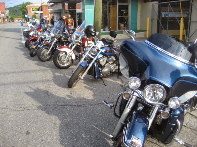
Valkyrie riders. Arriving at the Mt. Rushmore View Inn, I pulled into the parking lot to see a sizable number of Valkyries parked and several gathered discussing their favorite subject, riding motorcycles, especially the Honda Valkyrie.
 This ended the first leg of the trip.  Next will be riding around the Badlands and then the journey back to Tennessee.  Good riding to all.

The Ride To Nowhere

Made a last minute decision this morning to go riding since the weather was looking so great.  Mid 30s or so early and warmed up to 70 during the day.  A group was meeting about 20 miles away and departing the meeting area at 9:30 a.m. so I had plenty of time.  Took care of the dog, got the paper, donned my biking clothes and headed out at 8:15 as I needed to stop and gas up.  I got to the station, filled up the tank, cranked the engine and pulled up to the next pump to get some paper towels to dry up some spilt gas.  After wiping it down I started to crank it to make the meet up but all I got was click click click.  Riding friend Paul came up and I motioned him over, asking him to help push that 850 lb. beast off to get her started.  Boy I'm glad he showed up.  She cranked right up and I headed straight to the bike shop which was on the way to the meet up to get the battery checked.  Yep, my just under two year warranty battery was showing bad.  And they didn't have another like it in stock.  I was glad in a way as the bad battery was a gel type and that was my first one of and last of those.  The put a new battery in, gave it a quick charge, and off Paul and I went.  he decided to not ride with the group as he prefers one or two riders instead of a dozen.  Nice guy he is.

Since we didn't have a planned route Paul just led us all over everywhere as he has ridden nearly every road in East TN.  Really, he's been places that Google Maps rarely travel.

Below are some pictures of the area we rode.  It's amazing what you can see when you're just riding along with no particular place in mind to go.


Riding in the foothills.

Farms and Country Roads.

Rural America, East Tennessee

Filling a water tank the easy way.

This stream is spring fed and is the same water being used to fill the tank above.


Signs, farm implements, and whatever.

Nothing like riding twisties in the mountains.

Two mules and a horse with riding turning plow.

Old mill pond dam.

Natural rock ledge falls, plenty along this river.

Not all roads are smooth asphalt.

Mountain river through the woods.