The day is gorgeous as I turned right out of the subdivision. It is going to be a great day to ride. Cool in the morning and finally warming up to upper 60s in the afternoon.
About 2 1/2 miles from the house the pear trees are snowball white. And this was just one of thousands we would see today.
Met up with Paul and hooked it into beautiful downtown Knoxville via the James White Parkway. Next would be the I-275 over to I-75 and north bound and down. Sounds like an old Country Wester trucking song.
North on I-75 found the traffic pretty light at this hour. A large rock slide occurred about a week ago and only the Southbound lanes are open. Northbound have to exit at 134 and take a detour then get back on it a bit farther up. We would be exiting and not getting back on at all.
Flowering Redbud trees along the right of way. And plenty of those to see today also. Our route today would take us rambling around a passel of back roads up to the Big South Fork Recreational Area. This is a horse riders paradise with hundreds of trails they can ride. People come from all over to vacation here. They even have horse motels (motels with rooms and stables for your horses). A very large park, campground and outdoor area is available also. Very pretty.
All used up and discarded. A good caption for this pic.
Caught a quick pic of Paul about to ride under a Railroad crossing. It makes a sharp left, go under the tracks and then make a sharp right. No room for slow thinkers.
As we're crossing one of the mountains we managed to get behind a heavy laden log truck. So we followed and followed and finally he turned off.
This time he was crossing under a highway. Unusual on back roads.
The front roadside lawn of this property had Forsythia bushes planted to form a hedge. They can be trimmed and/or shaped fairly easy. They have very small leaves that turn bright yellow.
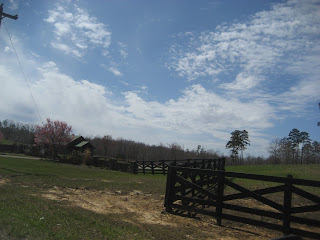
Horse country, big horse farms and lots and lots of fences to maintain. But really beautiful with nice rolling hills and green pastures.
After breakfast about half way here we finally arrived at Big South Fork. Now the adventure begins.
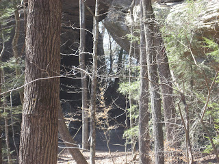
The road into Big South Fork has a number of large rock formations. Some look as if they were shot with a cannon loaded with grape shot. Lots of little and big holes where the limestone dissolved leaving the harder sandstone and granite.
The roadway going into the area is a state highway and is well maintained.
This is green sediment from the rocks and is not stagnant water. The river is flowing. Just looks unusual.
Going into Big South Fork runs you very near Pickett State Park which is also a very nice place to camp and enjoy nature.
And the adventure really begins now. This is the 7 mile stretch of crushed rock road just to get to the parking lot of Twin Arches.
The road was in pretty good shape with a few chuck holes to dodge and some loose gravel on the hills. Keep your hand off the front brake. Just keep telling yourself this all the while you're on the rock.
No traffic to speak of. I think we met one car coming out as we were going in and one care meeting us as we were going out. At this time of year it is rather quiet.
At the parking lot you get an opportunity to look at a map of Big South Fork and the Twin Arches Loop Trail within Big South Fork.
Paul just getting out of his gear and walking over to read the bulletin board and the signs.
A little difficult to see but that upper part of the loop is where we're going to trek to.
From the parking lot just follow the sign and if you're fortunate you can get to see both arches and return to the parking lot. Side info: you will be dropping 400' in elevation to get to the arches. That means you will climb 400' in elevation coming back. Believe me, it is much easier going down.
Paul clipping along on a downward slope of the trail and this was one of the better parts.
First set of steps looking downward. Handrails are slick from all of the hands that have rubbed the splinters off and not easy to grasp. Sure footed is the word of the day.
Paul at the bottom of the steps, me looking down at him for this pic.
Another section of steps and all the time telling yourself you have to come back this same route. You really don't but the alternative is a much longer route and much harder. Also remember, these 4 knees have a combined age of 150 years of wear and tear.
The rock formations along the route were very unusual. Here it looks like slabs of rock layered, maybe some rock pancakes.
 One of the bridges the trail has which crosses a small spring run-off. Brother Paul acting like he's a movie star.
 The North Arch. These are two of the largest arches east of the MS River, All of the scoop is on the map but you can go to the internet to garner that info.
There's no sign showing where the South Arch is, you just have to follow the path and hope it is the right one. Here's the South Arch from near the North Arch.
Most unusual rock formations here. You can see pock marks on most of the rocks as the Eastern portion of TN has a lot of limestone which means a lot of caves and potential sinkholes.
The South Arch. I have to say they look very majestic and all natural in the making.
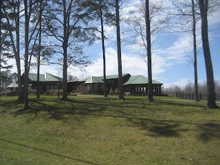
After we hiked back up to the bikes all I wanted to do was lock onto an oxygen tank and a couch. But, alas, we had miles to travel to get back to the house. Here we are passing a large horse farm which had some very pretty out buildings or barns.
Here's one of the barns (I could stay there and call it Home).
And this rambling structure was the main house. A very nice place with some big dollars associated with it.
A short time later we found another one of those semi-narrow back roads heading in the right direction so we took it.
Pear trees blooming in the distance, and those big high white clouds with a tinge of blue sky just sets them off.
Some of these back roads seem to have followed a cow path back to the barn. They could have been straighter but then that would require for a boring ride.
These Bradford Pear Trees decorate the drive to a school. The white clouds make it look even nicer.
A picture of me taking a picture for you.
Spring has definitely sprung. But then we're also expecting rain and low 30s on Saturday and rain and freezing Sunday night.
I-140 better known locally as the Pellissipi Parkway. Redbud trees along the fence line and thousands of daffodils planted on the slopes.
 More Redbuds and Daffodils.
 Sweeping to an end where we will turn onto a two lane highway and eventually find our way back to Seymour, TN.
As you age you seem to want to fill your days to the top. Must be one of those natural things saying the end is closer than the beginning. How often do we just let things go by without noticing them or letting people go by without taking the opportunity to speak. Once it's gone, it's gone forever. So until the next adventure, take a few moments to consider looking at some things around you that you just haven't taken the time to do. Amazing what may be in your own back yard that you haven't seen. Drive/ride safe.


No comments:
Post a Comment