Saturday, Jan. 30, 2016. Temp. 28*F. Previous plans had been made to ride with a group of riders, one of which I knew and that was the leader for the ride. We were to meet up at the BP Station at Walland, TN and leave there at 9:30. However, even the best made plans can go awry. It was heavy frost and cold this morning when I pushed the Honda NC700X out of the garage. I was donned in all of my heavy winter garb along with the heated gloves.
I took off for Walland with time to spare as I wanted to gas up down there to start the ride to Chattanooga, TN to have a BBQ lunch ride with the group. I took mostly back roads to Walland and pulled into the BP station, gassed up, pulled it up to the front of the convenience store to grab a cup of coffee before we left. Funny, I didn't see any bikes and they would normally be there by now. So I asked the lady behind the counter what time did she have and she told me which was the same as my watch indicated, 9:27. I mentioned to her that I was meeting a group of riders here. A fellow eating breakfast told me that a group of riders had not long left heading towards the Foothills Parkway. I finished my coffee, mounted my trusty steed and headed out after the riders. All I knew was they were heading to Cleveland and by-pass Chattanooga to eat BBQ. I didn't remember the name of the restaurant. So the story begins.

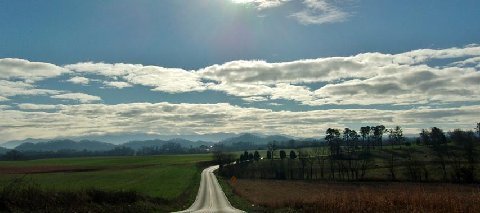
This is the approximate route I took, with a few side roads near the start of the ride. It was a gorgeous day, high wispy clouds and a big blue sky.
I only took a few pics between the house and Walland. I was more interested in looking for salt or salt dust on the pavement and ice. But who in their right mind would not like a morning like this. Even with the layer of frost it is still pretty.
A typical East TN backroad view early in the morning. A good place for a cemetery and a church, located at the intersection of two roads. Some of those headstones may have been from someone not stopping at the stop signs.
I didn't take any pics while I was on the Foothills Parkway because I was too busy hanging the curves and watching for LEOs. Trying to catch up to the group had me pushing it just a tad, well, to be honest, a little more than a tad. I ran US 129 from the Foothills back to US 411 but figured the group would take 72 which was a shorter route. But on 411 I could twist it a little more to catch up.
This route takes you through several small towns whose store fronts all seem to look alike.
Just south of Athens, TN an Amish buggy was easing along the shoulder of the road. There is a good size Amish community in this area. And to alert the vehicle drivers, there's yellow and black signs showing a horse and buggy.
I rode through Cleveland, TN for the first time in many years. Interstate highways by-passes most of these quaint little towns these days.
Catching TN 58 West of Cleveland I ran it down to Harrison and noticed this big house sitting on top of the knoll with a pretty lake in front. The lake was dug to supply dirt for the highway as this is apparently a low area.
I ran 58 into the edge of Chattanooga and in the process ran a portion of the ridge that several of us rode on a few weeks ago. This is just a nice stretch of open road with very few vehicles. Which was a good thing.
The lake at Harrison, TN which is just North of Chattanooga. It is quite large and today the wind had just a slight ripple on the water. This was changing because the wind has picked up due to a weather front moving in.
I ate BBQ at Shuford's which is located at the junction of US 27 and US 127 in Signal Mtn., TN. It has been in this location for 30 years. At their pulled pork plate with delicious green beans and turnip greens. And yes, a piece of cornbread. Delicious if I do say so. After lunch I ran US 127 West toward Dunlap, TN. Nice rock outcroppings along the way.
The route takes you over the mountain and after a ways you start to see a deep valley below you. This valley is Sequatchie Valley. I've written about it before but I usually catch it farther North. It is a nice twistie highway crossing over the mountains.
When you hit the top of the mountain you are now on the Plateau where the terrain turns a bit flatter with some slight rolls in it.
After a few miles you start to descend the Plateau heading for the valley below.
And watch the signs for there are several areas where the downgrade is 8 to 9 %. And the curves can sneak up on you quicker than a blink of the eye.
Sort of like this one.
But it is so pretty even with the leaves all gone. I guess it's the ruggedness of the area that appeals to me. Just trying to imagine the first settlers trying to get their wagons and belongings over these mountains is beyond me. A hard struggle on a good day.
Heading down you catch glimpses of the valley below and also the mountain range on the western side of the valley.
A little twist here, a little twist there, mountains every where.

I rounded a curve and in the space between it and the next curve I glanced over to see an open mine entrance. A SUV was parked nearby so I slowed to a stop and made a u-turn to go back and take a closer look. I eased the bike off the highway onto the crushed rock, being real careful not to let it slide out from beneath me. Shut it down, pulled off my gloves and took a walk over to get a closer look.
I noticed the young girl and heard other voices. It seems her mother, brother and another girl along with their dog had climbed up the sloping side to the top above the mine entrance. Or I should say, mine entrances as there was 3 shafts here. I would think the mines were dug for granite or limestone. The young man told me they went about 200 yds. back and split off ending at a pond. Couldn't believe they were not barricaded.
Once you hit the valley it just becomes more beautiful and relaxing. It is a very straight road for miles and miles.
Mountains on the East of you.
And mountains on the West of you. Lo, as I ride through the valley of beauty I think of the greatness our United States has to offer and the amazing things He made for us.
Cows, horses, pasture land and a house every so often. And miles and miles of highway I must ride before the end.

I stopped in Pikeville at a Hardee's to grab a cup of coffee and take a break. Now this place could use some personnel changing. Four people behind the counter, and 5 customers inside, 1 waiting on his order, one who was angry because they totally messed up his order, a lady trying to get the rest of her order, someone waiting outside in a car for their order and I had made the mistake of ordering and paying. The must have missed their Meth today.
After a short break I rolled on toward Crossville. Beautiful pasture on my right.
Mountains in the distance meant that I was getting closer to Crossville where I would take a right and head back East.
The sky and the mountains were just so pretty today. I guess it must have been the light, the shading or maybe it was because I had not been out this way in a few weeks. Whatever the reason, it was beautiful.

One of those government missile silos sticking up over the rise. You'd think people would have recognized they were not that well hidden by now.

And with all of the snow, ice and cold yet the grass is still green. Doesn't look like my yard for sure.

Hung a right onto TN 68 which would take me over toward Rockwood. This also takes you up over the Plateau, across the mountains and through one of the areas where various stone is shipped all over the country from. Lots of rock quarries in this area.
Like sentinels all in a row, the leafless trees stand guard until Spring comes again. Then you won't be able to see beyond their trunks.
One of the many stone quarries along the highway.
And one of the many lots selling stone by the piece or by the truck load.
Made a left turn and into Rockwood we went. Just a short way up the road we hit I-40 eastbound and down for Knoxville.
The temperature had warmed up by noon and the day just seemed to get better by the minute. By now it was about 4 p.m. My day was coming to an end but not after a wild dash on the superslab.
That white stuff in the distance is snow still on the ground up on top of the mountain I was crossing. Still needed to watch in the shadows for ice patches that would change your direction in less than a heartbeat.
I caught up to the traffic in Knoxville, rode along with it until I got to the I-140 turnoff. It was now about 4:30 and time to get back to the house. I blistered across the TN River just to open the 700 up a bit. It is a nice little machine for what it was designed for. And that is doing some paved roads and some unpaved roads. It is not a cruiser but some people use it for that purpose. If the seat was a bit easier on my rump, it would handle a long haul after some saddlebags were added so that you would have room to carry your belongings.
I haven't named this bike yet, been kicking around a few names to see if it fits, but Little Hoss is about to become the winner. We did 356 miles door t door on this ride averaging 68.4 mpg. And I rode it hard with a hard wind to face. Not bad at all. Ole Sweet Thang wold have used 3 to 4 times the amount of gas that I put in today mainly because of the wind and that big windshield she carries. I must say I'm impressed with Little Hoss. He's got stamina.
I had a great day today even though it didn't start off as I had planned. However the finish was the same, a great time, great miles and great smiles. Until he next adventure, watch where you walk, meet a stranger and smile and enjoy life.


 I rounded a curve and in the space between it and the next curve I glanced over to see an open mine entrance. A SUV was parked nearby so I slowed to a stop and made a u-turn to go back and take a closer look. I eased the bike off the highway onto the crushed rock, being real careful not to let it slide out from beneath me. Shut it down, pulled off my gloves and took a walk over to get a closer look.


 I stopped in Pikeville at a Hardee's to grab a cup of coffee and take a break. Now this place could use some personnel changing. Four people behind the counter, and 5 customers inside, 1 waiting on his order, one who was angry because they totally messed up his order, a lady trying to get the rest of her order, someone waiting outside in a car for their order and I had made the mistake of ordering and paying. The must have missed their Meth today.


 One of those government missile silos sticking up over the rise. You'd think people would have recognized they were not that well hidden by now.
  And with all of the snow, ice and cold yet the grass is still green. Doesn't look like my yard for sure.
 Hung a right onto TN 68 which would take me over toward Rockwood. This also takes you up over the Plateau, across the mountains and through one of the areas where various stone is shipped all over the country from. Lots of rock quarries in this area.