Friday morning, 7:40 a.m., chilly, around low 53 degrees, minor chance for rain in the morning hours but gone by 9:00 or so. Who cares, it's time to ride. So I donned my winter jacket, chaps, heated gloves and left for the Exxon meet-up with Paul, a.k.a., Mr. Google Himself (they call him once a week just to make sure they have all of the roads mapped). It's going to be a long ride.
This is the route for the day. Run up Boyds Creek Hwy. to meet up with Paul and onward to TN Rt. 66, left to I-40 and East on 40 past Newport for turn off on NC 209 (Fines Creek). We don't run a lot of interstate highways but today we were to save time since our objective was several miles above Asheville, NC to catch the Blue Ridge Parkway.
As I pulled out of my subdivision heading eastward the sun was just ready to break the horizon. A little better than pulling out before sun up in the dark and fog.
Farther up Boyds Creek you can start to see that it's going to be one great day.
Just before Boyds Creek Hwy. hits TN Route 66 the crane was silhouetted against the sunrise. Believe me when I say this, living in the mountains totally messes up your sense of direction. After you make a few turns, run around a few hills, drop into a valley, North, South, East, and West becomes East, South, West, North and now you don't know really where you are unless the sun is shining.
Mixed it up with the morning commuters and finally arrived at I-40. Their new traffic pattern is confusing to say the least. But for us it was the same old "make a right turn onto the ramp" heading East.
After a few miles you could start to see the mountains in the foreground. The Smoky Mtns., and today they were smok'n. I-40 was rather clear in this area but you either catch up to the traffic or the traffic catches up to you. It doesn't stay this clear very long.
We made our first exit from the interstate onto NC 209 which turns into "The Rattler" farther up but we wouldn't go that far today. That red barn isn't that far off the edge of the pavement and in some places the buildings are no more than 10 ft. off the pavement. When the ground is mountainous, level land is precious and they use every inch of it.
The sky has cleared and the tree leaves are turning beside this old wooden church.
When is a school building not a school building? When it's used for anything else but educating children. I don't know if all the kids grew up and they no longer needed it or it was just too old to use for school any more. Either way, the community put it to use.
Every once in a while on this highway you would run through a valley which allowed for a few straight-aways. And we took advantage of every one of them.
The straight sections soon end and we start back into the curves again. Drats, and I just hate these curves, like a chocoholic hates chocolate.
Did I mention curves? Love this sweeper but you have to keep your wits because sometimes they do a change up and ooops, I think I just messed up. Causes you to grip the seat tighter.
The surface is rather new and that makes the ride much smoother and a tad bit quicker. You're not dodging pot holes or patch spots while you're maneuvering curves and climbing the mountain.
The large tree on the left is about half way in the turning stage. It is a Maple tree. Depending on the type Maple, the leaves can go from green to red or green to yellow or green to yellow and red. Then they turn brown and fall off.
Nice sweeper with some heavy leaf accumulation on the shoulders. No drifting on these roads, keep it on the pavement. Errors are costly in mechanical and human damage.
It's nice when you can see all the way around the curve you're about to take on.
And then a little loafing along to line up a good pic. Getting higher in the mountains and more color.
Yep, that's where I'm going right after I round the curve before it.
Back down into the valley and more old barns and buildings.
Some nice farmland in this area. I saw a field of tomatoes that won't make it this year because it apparently was planted late and the freeze this weekend will wipe out the fruit. And the plants. I also saw a field of corn that was just tossling out so you know that will be turned into fodder as there's not enough time for the ears to mature. Seasonal changes. Farmers often roll the dice and sometimes lose.
Little country stores dot the mountain roads. No Walmarts here or big food chain stores. If you need something more than emergency supplies you're going to take a long drive.
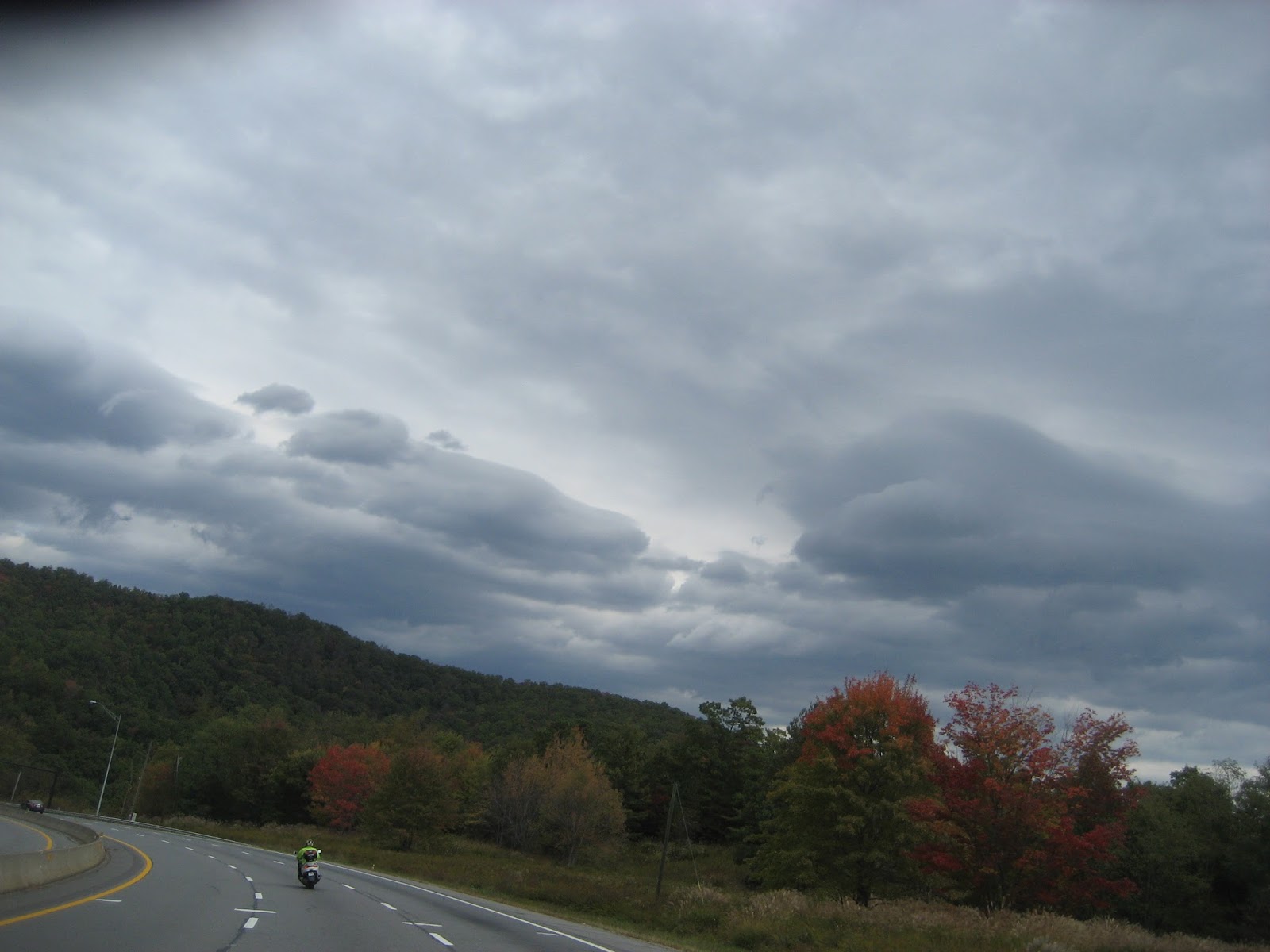
Back out onto the interstate and looking in the direction of the cold front moving our way. Makes you think of the song "Stormy Weather". Rolling the dice, gonna get wet or not, that is the question.
Just a look at the foliage along the hwy.
Ominous clouds make a nice background for the changing colors.
This particular section of the interstate has a very long downhill grade of 6% which is not bad for motorcycles and cars but play heck when towing a trailer or for those big semi's. You get the aroma of burning brake shoes/pads. That is the last sign for "runaway truck ramp". There was 5 or 6 such ramps should a truck lose its brakes they can exit through a very rough sand uphill ramp.
We turn off the interstate into the town of Old Fort, NC. This puts us on NC 80 for an uphill (mountain actually) ride to get to the Blue Ridge Parkway.
First time I've seen a blanket symbol on a downtown building. These are usually found on barns.
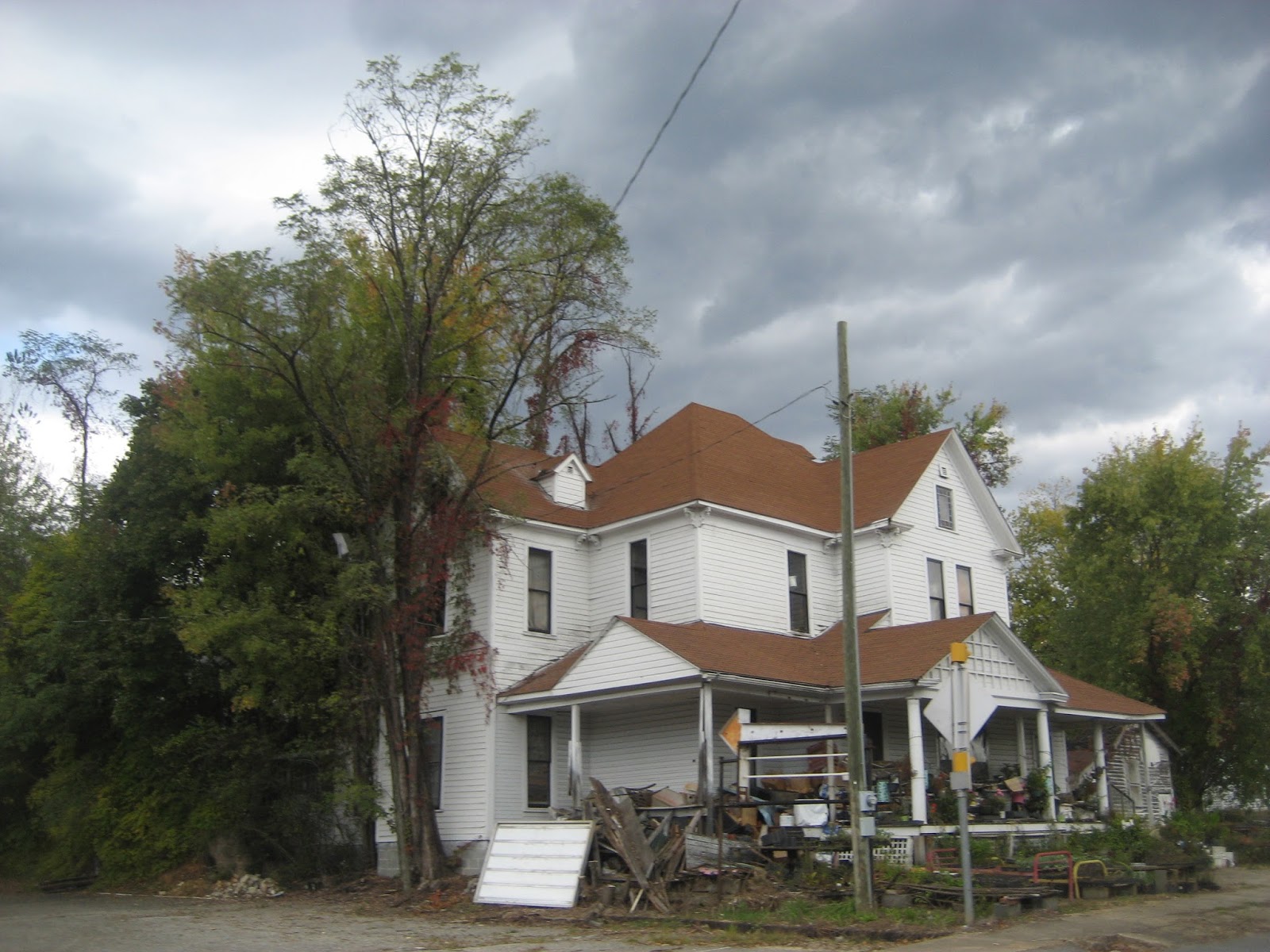
One time this old house, which is very large, was an elegant place but today it is more of a hoarder's place. Lots of junk and still within the town limits.

Not too far out of town we start on the curvy roads and back into the forest.
Passing a very large lake, the structure in the water is the area water intake.
The farther we ride the heavier the clouds look. But you have faith for way off in the distance beneath those dark clouds is a speck of blue sky.
Mother Nature takes care of its own. Trees growing out of dirt I can understand but growing out of rocks is a bit more than I grasp.
That vehicle in the curve with the orange color is a pickup hauling several guys sitting on top of a dog box all decked out in their safety orange. It's bear season in NC. this is just one of several groups we ran across on our way up to the BRP.
Then we finally hit the BRP. Time to sit back and enjoy the scenery for we will be on it for a while.
Mother Nature showing off. The sun came out, the dark clouds were not as present but the beauty was just as great.
One of the many pull-offs along the Blue Ridge.
We were heading toward Mt. Mitchell which is the highest point on the Blue Ridge. We have been to the parking area and up to the mountain but today we were just going to drive by.
Unfortunately the sunlight aids in washing out the true colors but take my word, they are nice and a week from now will be peaked out.
Cloud shadows Mt. Mitchell in the distance.
Talking about contrast, Blue and Gold. Sounds like some High School or College team colors.
Smoky Mtns. framed behind a stand of hardwood trees that have already lost most of their leaves. The mountains and sky almost become one in color.
Paul and I pulled into this turn-out so that he could wipe his eyes. Apparently the wind and the spores was making him tear up. Or maybe it was just a sentimental moment. Either way, we took a couple of pictures while stopped. We're over a mile above sea level.
Scene from Graybeard Mtn. turn-out.
And another scene from the same place but aimed in a different direction.
And the last scene from Graybeard Mtn. turn-out.
Looking Eastward from the Blue Ridge Parkway.
We dropped off the Blue Ridge and took a route into Weaverville, NC where we grabbed U.S. 25/70 back to Newport, TN.
Lots of nice woodlands along 25/70 and with some great sweeper curves.


Heading back to the house but will make a pit and fuel stop in Newport, TN.
It was a great day to ride. No sweating on this trip as the temps stayed in the lower 60s. The scenery was splendid, the atmosphere was comforting, and the friendship was wonderful. Mother Nature has a lot to offer and I hope each person gets a chance to really see what the United States has. I've been fortunate to see a great piece of it and never tire of finding new and different places as well as revisiting some I've been to.
Spent about 8 hours on this trip and total mileage was 292 miles door to door. A little tired but not so that I wouldn't do another trip the next day. Friends, family and fun all seem to go well together. We just need to turn loose some baggage and enjoy this life we have. Please do so. Don't make a bucket list, just do it.
So until the next Valkyrie Adventure, which should be next week, stay safe, sleep well and be thankful for what you have. It could be worse.


 Not too far out of town we start on the curvy roads and back into the forest.


 Heading back to the house but will make a pit and fuel stop in Newport, TN.
No comments:
Post a Comment