It was Friday, July 31, 2005. The morning air was cool, upper 60s, but you knew it was going to warm up as time ticked by. A good day for a ride as there was no rain included in the forecast, just heat. And ride we did. I met up with friend biker Paul shortly after 7:30 a.m. and we pulled out for some NC back roads. Sweet Thang was purring in the cool morning air. You could just sense her wanting to crank up the power but then you restrained yourself knowing it wasn't safe nor legal to do so.
Early morning starts in the Spring and Summer are just plain nice and simply pretty. Especially when the sun is starting its trip of the day and you're trying to beat its heat.
A tad bit of mist laying in the low lands along the hills. Most people probably don't even notice this aspect of an early morning. One nice thing about being on a bike, you are there and get to experience and participate in nature's wonders, some good and some not so good.

Clipping along Boyds Crk. Highway heading to TN Rte. 66. No, no reference to the famous U.S. Rte. 66., but still the same number. Gateway from I-40 to the Smoky Mtns. and vacation land.
It was just an exceptional sunrise today, as if the world knew we needed to be out exploring. And truly I did need a break.
One of my favorite sites, the Seven Islands School House, caught in a family squabble such that it is slowly deteriorating. Sad matter but I have had a chance to take pictures of this building in all the seasons of the year.
Yep, that direction is where we're heading but it's miles before we sleep but not too many before we eat.
Paul made up the route we were riding today and the first part took us East on I-40. Interstate riding doesn't bother me but friend Paul has a dislike for those big rigs that you pass or that are passing you like this one. I just get in there and mix it up with them. God watches out for us dummies.
Here Paul is being passed by the same truck as in the above picture. North Carolina looming in the background.
I-40 going from TN thru the mtns. to NC is a great ride. This morning it was even a bit cooler as the ride was mostly in the shade of the mountains. The road has a lot of sweeping curves and for once we got ahead of the trucks and RVs. Parts of this route has some pretty good climbs for big rigs.
We hopped off I-40 onto Fines Creek exit which is the lower end of the Rattler (NC 209) which will take you to Hot Springs, NC. Of course we didn't stay on it all the way to Hot Springs as our destination was Ingle's Food Store in Marshall, and a cup of coffee and apple fritters. I did use the plural of fritter in this case.
Taking this route you pass a number of missile silos disguised as farm buildings. Now you just read this again didn't you?
Squeezed in between the mountain, the highway and the forest you manage to find a small acreage farm or a farm with a small number of acres of tillable land.
It is pretty country, lots of hills mixed in with the mountains and every where you can, you use the ground for making crops or pastures.
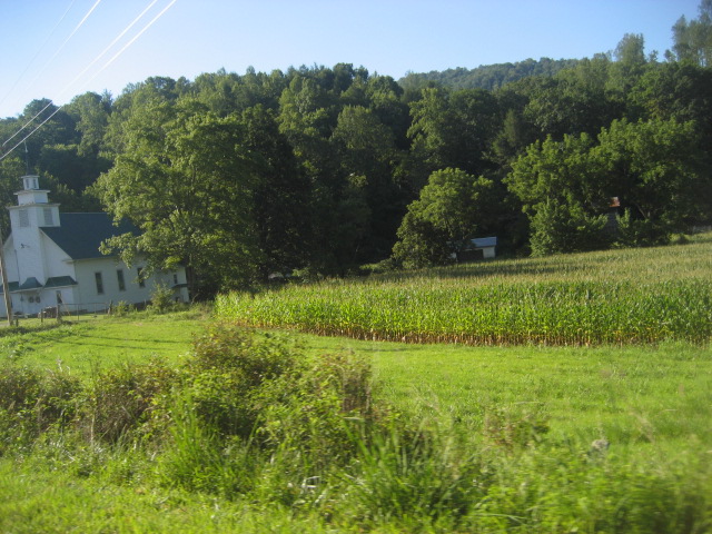
As my Grandfather would say, "this is a good stand of corn". What's funny is this is moonshine country with corn being grown right next to a church. Hmmm.
A nice patch of colorful flowers stands among that rock edged garden. Since everything is green they really stood out as we passed them by.
And from this vantage point the corn looks almost as tall as the barn or shed. And it is pretty tall and all tassled out. Rich green leaves. Good bottom soil along with some fertilizer.
Farther on we start getting closer to the mountains which are looming in the background. Then this straight road becomes a corkscrew.
We traveled several side roads that went a few miles and dead-ended in someone's front yard and some of these roads stopped having a paved surface and it turned to gravel. At the change point we turned around. No gravel road riding today.
A small stream ran alongside this road which snaked among the hills and woods. Talk about quiet. You could shut off the engine and think that you're in a vacuum.
I figured this was designed for drive by sermons. Just stop in front of the door, drop your money in the plate, say a short prayer and be off again. As mentioned in some other Adventure articles, they don't waste an inch of land in some of these places, especially if it's flat land.
Here we have the stream on the right side of the road but don't worry, it will be on the left in a little while. This narrow valley is squeezed between to mountains so there's not much room for anything really big, including farm fields.
This missile silo seems to have blown its top. Must have had a fuel leak. Sure was built close to the stream.
Paul's question about this place was "how do they get a full tank of gas with everything on an incline?" A Picker's Paradise. Old store, old signs, old gas pumps, in an old neighborhood.
Along our route we passed a well known biker stopping place. Groceries, deli, clothes, and memorability. Not to mention the tales and lies spoken.
Not far down the road was a quaint stone house, small, similar to a Tiny House but this one was not on wheels.
And right next to it was this tiny church building. Kind of odd stuck way out here in the country but very pretty and well taken care of. Just thinking, may have been built for tiny people.
Hanging a curve riding through the mountains. What scenery. Sure wasn't made by Man or it would have been a mess. I have to watch it since I'm eating a gooey brownie while I'm typing this. The sugar may go to my head at any time now.
Hay on the ground. With this weather it will be fluffy and ready to bail in a day or so.
When a barn is no longer a barn it becomes useful as a construction office. Also a good place to drop off equipment and junk.
Friend Paul with his "White Rat" Burgman Scooter. He has just sold his Red Ninja 500 and purchased a Honda 600. The Honda is a newer bike and gets great gas mileage as it's fuel injected where the Ninja has carburetors.
This was one of those roads that stopped being paved and started being gravel, probably someone's driveway. Paul with Sweet Thang on his left and White Rat behind him. Nice view from this point.
Lots of Queen Anne's Lace growing along the roadway. Looks like a snowflake.
Crossing the Holston River. A lot of rafting and kayaking is done on this stretch of water. Need some experience as there are some rapids and a small waterfall to deal with.

Lots of Crepe Myrtles blooming at this time of year. The red ones are very bright against the green back ground of trees.
I just found this house and its color to be a bit unusual. It does have a nice setting and you certainly can't miss it as you drive by.
Then you come to the defunct town of Branard, NC. Population maybe 6 or 8. Store is no longer in business and not much else around here. Makes you think of those living in the area as to how they make a living and believe me, it's a far piece to a Wal-Mart.

A NC driveway. Makes you just a tad nervous thinking about going over it at night.
If you happen to notice, they don't spend a lot of money on guardrails on most of these highways we travel. Lots of barbed wire fences though.
Another road and another roadside stream. One goes in one direction the other in two directions. Imagine that.
Another building of a gone by era. Just waiting in the sun. Once a proud structure used on a daily basis. Now just a hulk of lumber covered with a rusty metal roof. Alas, such as it is when progress quits progressing.
A little close-up of a babbling brook.
An old farm house nestled in the valley, probably from the early 1900s.
On our way to and from one of those dead-end roads we passed this old barn and dilapidated wooden silo. It is the first of its type I have seen in all of the roads we've traveled. Just kindling now as if it caught fire it would be on the ground in just a few minutes. Well seasoned wood.
Back at Barnard, NC we stopped at a small roadside park. It's also a drop off place for rafters and kayakers. The Holston River joins up with the French Broad River just northeast of Knoxville, TN and makes up the Tennessee River. Now you've had your geography lesson for the day.
Finally it's time to turn back toward the house. Love these roads as they are wider with sweeping curves and often slow vehicle passing lanes that we take full advantage of when necessary.
The day was great. White smoke signals against the bright blue sky, the sun baking your brains out and the wind whistling past your helmet. Deodorant died hours ago but who cares, you're out there riding the wind and enjoying new sights with a grin on your face from ear to ear. For a while a free spirit on two wheels.
Door to door today was 228 miles of interstate, main highways and lowly byways. We smelled and saw nature, mingled with some of the country folk and frittered away apple fritters with gulps of coffee all the while returning to our houses safe and sound. Just how much better can it get.
So until the next Valkyrie Adventure, smile at your neighbors, say hello to a stranger and be on your best behavior because you just never know. And remember, your Momma's watching and she knows.
 Doug and I pulled out at 7:30 a.m. planning to take a break around Pikeville which would be about half way, give or take a few miles. It was one of those clear crisp mornings which made my mesh riding jacket feel good, in fact I even threatened to stop and put my rain liner on beneath it. But I eventually got use to the coolness and later was glad that I had not put the liner on.


 Today was yard sale day. They were everywhere. Some even out in an open field. I guess they get there early to get the better spots. And they're on both sides of the road so you have to really watch the traffic moving and stopped along the road way. Who knows, Ma may have spotted an old wash tub on the other side of the road and she just makes the turn, to heck with the traffic.