It was in the upper 60s when we pulled out of my area at 6:45 a.m. Biker friend Paul and I headed south for a while, then West for a while and then really tuned west when we hit I-40 towards Nashville.
Looking East at my subdivision entrance. And not long after this shot up rode my riding buddy, Paul.
Looking at the sunrise behind us as we were heading South on US 411 toward Maryville, TN.
A light fog was over a lot of the ground area but none on the highway. Misty mystical mountains in the background.

Don't you just love the colors of sunrises and sunsets. And often the clouds enhance the colors with their shapes.
We were crossing one of the fingers off the TN River while riding the Pellissippi Parkway or actually I-140.
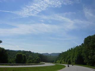
Farther Westward on our ride the fresh morning air, the greenery along and over the roadway made this stretch very restful.
Then we start hitting a few nice sweeper curves, just enough to make you feel a little adrenaline rush.
We stopped in Wartburg to grab a breakfast sandwich and coffee before riding into the Catoosa Wildlife Area. This place is huge with a number of gravel roads that extend for miles and who knows how many trails for off-road riding.
The Obed River runs through this area and has a history of its own. Many yeas ago there was a big flood that did a lot of damage. A good place to read about the Obed River and the Nemo Bridge is below and well worth the time to read it.
 https://www.nps.gov/obed/learn/historyculture/places.htm.
 Nemo Bidge, no longer used for vehicular traffic as there is now a rather new concrete and steel bridge a few feet from it. A lot of people still walk on the bridge to take pictures of the Obed River and the area.
www.morgancountytn.gov/tourism/catoosa_wildlife_management_area.php is a great site to learn more about this 82,000 acre wilderness. It pays to get a map and study it very carefully as you can wander around in here for days trying to find your way out.

After a few miles we came to a 4-way junction. Paul carefully reviewed his GPS (& L), you all know what the GPS stands for, Global Positioning System. Well, the & L stands for Global Positioning System and Lost. Sometimes it takes us down the wrong road/path causing a U-Turn effect.
 So, do we take the left road,
The Center Raod,
Or The Right Road.
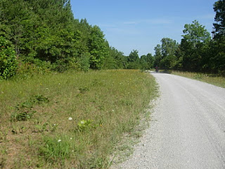
The right road it was. Gravel was in good shape and not very dusty. Apparently they have had some recent rains, some places more than others.
 We crossed several streams and one view to the left looked as if the water was coming out of the rock or mountain.
 To the right it looked like a small ditch with a small amount of water.
But as you traveled farther up the road you could see the water comes from in front of that rock outcropping and below it was a very large pool of water. I suspected it to be a swimming hole and even considered doing some skinny dipping as it was getting warm.
You climbed up onto the Plateau with several nice tricky switchbacks on gravel but once on the Plateau it was just up and down some small rolling hills.
Up on the Plateau you could see that logging of the timber had occurred not too many weeks ago. In fact, this trailer was loaded with logs but no truck.
And nearby was this large road packing equipment, the type that is pulled behind a large tractor. Lost? Or maybe just forgotten. Seems funny to not see large amounts of trees.
 We continued on through Catoosa enjoying the scenery, the weather and the wildlife. Saw a couple of deer and lots of birds and butterflies. And lots of blue blue sky.
 Yet another bridge over a stream with water so clear you could see the bottom and the small fish swimming in it.
  Riding on as the time is starting to get close to noon and we had expected to get back to our starting point by two.
  Once this area was farm land and some rememberances still exist like this old cemetery. I fist thought it said Old Farts Cemetery but then a closer look let me know that it wasn't.
 I told Paul this and he said that we needed to get out of there immediately since we were both old. A lot of the graves had just a slab of rock as their marker, no inscriptions, no names, just a burial spot.
After a while we finally rode to the other entrance to Catoosa. It had been a very pleasant ride. In some areas they planted corn for the animals and I noticed a wide variety of wild flowers along the road's edge and in the open spaces.
Not far up the road we left the gravel and was now on hard surface roads. Heading back to the house.
A little farther we came to a State Forest Fire Tower. A good place to stop and rest and for the energetic, Paul, a good place to climb to the top. He stopped just a couple of stops from the top to get a panoramic view of the Plateau. I talked with the workers about the area.

Well it was until we rode by this stand alongside the highway and Paul quickly tuned on his turn signal and pulled off the road. He asked me if I had smelled the aroma as we passed and I said yes. He then wanted to know if I wanted to go back. Duh. Of course. These were the largest donuts I have ever seen. As big as a saucer and about 1.5 inches thick and fresh.
 After eating that donut and washing it down with a cup of coffee we headed back toward Seymour, all the while looking at the growing dark cloud. I kept thinking we were going to get soaked but we didn't.
We made a short gas stop for Paul, hit I-40 again heading East and after a while we got off for some more scenic highways to the house. No rain, good donuts, and 218 miles later the riding day was over. We had a great time riding in Catoosa and going and coming on the other roads.
Until the next adventure ride, explore your own area for those hidden treasures that few seem to know about.


