After a quick breakfast we headed out for Pilot station at the Gatlinburg end of Pigeon Forge. I wanted to fill my bike, Little Hoss, for the ride as I already had over a hundred miles on it since its last fill up. Traffic through the "Run", that's the strip of US 441 going through Sevierville to Gatlinburg, was somewhat light this early so we made good time.
Meet-up point was the Sugarlands Visitor Center in the Smoky Mountain National Park just outside of Gatlinburg. We arrived there about 40 minutes before KSU (Kick Stands Up) which was set for 10 a.m. Riders were coming from several directions. Gave me time to drink that cup of coffee I purchased when I gassed up.
Some of the riding group. Robert's red Spyder, Little Hoss, Terry's HD (the ride leader), and some new folks to me plus some across the parking lot as well. Nine bikes, some with two-up. Nice bunch of folks to spend the day with.
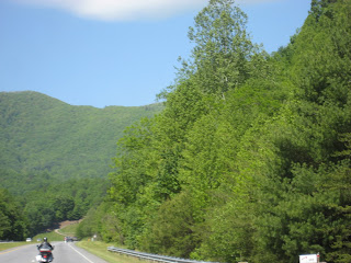
Leaving Sugarlands for Cherokee, NC. Green is the color of the day.
One of the most photographed sites in the Park. I think I have a photo of it in each season, including with ice on top and snow scenes.
First tunnel of the day. Terry rides into the mouth of the mountain. And the rest of us are just crazy enough to follow him.
Traffic wasn't too bad this morning but that will change on a day like this in minutes.
Naugh, it wouldn't rain on us today for sure. Just teasing.
Top of the mountain, Newfound Gap, parking lot already filled with sightseers and hikers. The Appalachian Trail crosses the mountain here. If you're walking to the North end of the trail you've got a long way to go. In fact, you won't even have your boots broken in since it starts in Northern GA and goes to Maine.
Nearing the point where you turn off for Clingman's Dome, the highest point in this area of the Smokies.
 Past Clingman's Dome turn off heading for Cherokee, NC.
Just love those mountains. And with the change of seasons and all of the rain we've had, they are back to green instead of gray.

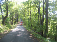
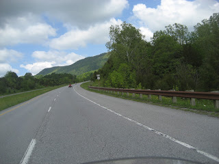
Riding down the Eastern slope of the mountains. About the only time you can take a picture is between the gaps of the trees.
 If you hit the guardrail, it becomes the launching point of your vehicle or your body exploring what's down below and it's going to hurt.
Leaving the National Park and about to enter the Cherokee Indian Reservation.
Cherokee, NC, land of the Eastern Band of the Cherokee Indian Nation and a tourist mecca. Including the closest Casino to TN on the East side of the state.
 There are numerous bears like this one throughout the city, some gayly painted with scenes and some with various Cherokee Indian symbols. The street signs have English and Cherokee language on them. As well as most of the buildings.
Heading Southeast towards Highlands, NC leaving behind Cherokee.
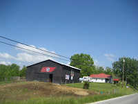
Spooky little place not to far out of Cherokee.
Humm, I wonder if these are smoke signals? May have a big Pow Wow in the making.
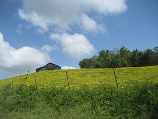
It sure feels great riding now that the weather is being more cooperative and the fresh smell of green grass and trees fills the air along with the pollen that comes with it. But that's what allergy pills are for. Taken by the handful.
Warning, 9% downhill grade for the next few miles. And today the wind has picked up making some speedy gusts. Have to watch it as you round the mountains.
Sign alerting truckers of a Run-away truck ramp ahead.
The run-away truck ramp. Lots of sand with ripples or humps in it to stop a truck that has brake failure. Bill bounce you a bit but that's a lot better than running over the edge of the road into the valley below.
Later we pulled into the historic town of Franklin, NC.
Leaving Franklin, NC heading for Highlands, NC.
Cemetery in a curve, what a coincidence.
Some nice curves on the way to Highlands, NC.
Beneath those green trees is a very rugged piece of rock.
No room for error here, solid rock on one side and a steep drop-off on the other side. Guardrail is primarily for cars for if a bike hits it, the rider becomes a missile without an engine or guidance system.
 One of the reasons for the ride. This waterfall is elegant enough to warrant a larger view. We had to bypass one set of falls due to the lack of parking space. Even the parking lot for this one was full but we squeezed in anyway. This is Dry Falls. Doesn't look dry to me.
A trail leads down from the top of the falls and actually goes behind them for a distance. I made this trek once but lack of breathing capability and knees kept me at a higher point. It is very pretty and well visited.
In this picture you can see a man leaving from behind the falls walking to the end of the path.
Another view point of this beautiful waterfall.
Friend Robert took this just to prove I wasn't sitting at the casino or some restaurant table.
The next set of falls you can actually drive/ride/walk behind but today they had a sign up warning vehicles of falling rock. Funny, nothing said about people walking under the falls.
Just to capture that one great moment, couldn't resist the urge. No, that's not me, but a couple that was riding with us. No rock damage. They had on their helmets just in case and because it's the law when riding a motorcycle in this and most states.
The amount of water depends on the amount of rain. Fairly low amount of water today. First time I came it was really coming over the top.
 We headed for the Highlands and then on to Cashiers, NC, two quaint
tourist and retirement towns snuggled in the mountains of North
Carolina.
 Stopped in Cashiers, gassed up and then headed back toward the house. Weather was great, group was great and scenery was fantastic. All in all, a wonderful day in the saddle. Door to door for me was 241 miles. And all on one tank of gas with gas left over. Little Hoss, Honda NC700X, does a good job of fuel squeezing.
To my friend Terry, thanks a bunch for setting this ride up. You picked some good roads, interesting places and a nice group of folks to do it with. Hope to do the same again soon. So until the next Adventure, I hope you take the time to smell the roses, visit some place you've never been and talked with a relative or friend about anything just to stay in touch. Most of all, stay safe.


