Saturday, 8-22-15, Temp. 67 to top out at 90, another good day to hit the asphalt. At 7:15 a.m. I backed Sweet Thang out of the garage after checking to make sure she was ready for the road. Had my windbreaker beneath my mesh riding jacket, gloves, helmet and was itching to go. Turned the key, hit the starter button and she came to life with a roar. Very throaty this morning in the cool air. We hit Boyds Creek Hwy. headed for the meet-up with friend Paul at the Exxon Station. It was foggy, rather thick fog, then the sun peeked out then fog, then sun, etc. After about 5 miles I pulled into the Exxon Sta., backed into a slot and waited for Paul. That didn't take long as he rode up in about 2 minutes, motioned if I was ready and I nodded yes as he pulled back out onto the highway. I cranked up and pulled out after him. Felt really good this morning with the cool air.
We headed to the 407 exit of I-40 to Micky Ds to meet up with two additional riders, Terry and Mike. Paul and I got there early enough to grab a cup of coffee and a breakfast burrito before the other two arrived. Then we pulled out heading for Kingsport, TN, just a bit south of Bristol, TN/VA. Little did we know that it was race day at Bristol. However, this didn't bother us as we would be taking all back roads to Kingsport. Our destination today, to do some historical looking at Exchange Place and Netherland Inn, two very prominent places in the late 1700s and early 1800s.
The sky was very blue with whispy white clouds very high in the atmosphere.
On our way we passed another one of those disguised military installations but this one was different. It had a profound aroma of a barnyard. Really authentic looking. They're making them harder and harder to find. In the words of Jethro, "this was a biggun".
At times "Ole Sol" seemed to not know exactly what it wanted to do but eventually it came out and stayed out very bright all day long. It also increased the temperature as the day went by.
I thought this was such a lonely looking little place and not a bad fixer-upper if you wanted to do that.
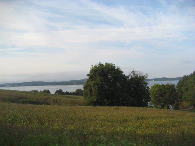
Our road eventually came out to the highway that goes from Sevierville to Dandridge. TN 92 runs along Douglas Lake, a very large TVA installation, and along its shores various size and class of houses are constructed.
You run along the lake and then into the woods and then back by the lake until you finally get to Dandridge. It is an old town, reminding one of Williamsburg, VA era construction.
This area is a fisherperson's paradise. Lots of bass, trout and such here. Bass Pro holds a tournament here and the last one launched over 1500 boats on the opening Friday.
Just another scenic view biking along TN back roads. What's that off in the distance? Is that a levee? Naw, not here, it's a cloud bank laying up against the mountains.
It may not be but a spit of land but someone will put a house, camp, trailer or tent along it for their second home and in some cases their primary abode. It that pink one loud enough?
Going out of Dandridge you start getting into the lesser traveled roads and some that have very little markings to separate lanes. What do you mean lanes, this one was a lane and a half wide.
Crossing streams, rivers, lake fingers, they're all up here. This is the Holston River, one of the rivers that makes up the Tennessee River.
Traveling with Paul allows you only so much time on one road before he's off onto another. Sometimes wider and sometimes smaller. And sometimes to a dead end. But then, we're always exploring to see what we haven't seen before.
A nice farm on a piece of land that is actually tillable. Just another disguise for a military installation. Seems they could put those missile silos to where they couldn't be seen so easily.
In its day, this was a grand house. However, that is a gone-by era in time. Today it's almost hidden by vines and brush, old gray boards just waiting for the end. Nothing stays the same forever so take advantage of what's there today for tomorrow it may be gone or replaced. Even us.
Riding through the trees and shade let the temperature drop a few degrees. That windbreaker beneath my riding jacket felt nice until about 10:30 and then it had to come off.
Just the sound of the wind by your helmet, the tires on the asphalt and the rumble of the engine, other than that, it was very quiet in this area.

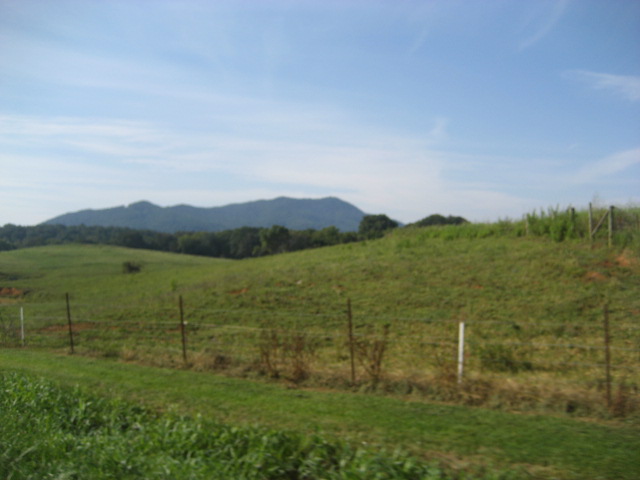
It doesn't make much difference from what angle you take a picture of the mountains, they look great.

Whether they are far off or close by, the loom on the horizon standing stately with an immovable stance. And they're right, who would want to move them.
I don't know if they ran out of paint or if this is a change in the county but all of a sudden we had center and side stripes again.
One of the old farm houses in the area. When I say old, this particular area goes back before Daniel Boone. This house isn't that old but it dates back to the early 1900s.
The last Valkyrie Adventure took us to the Great State of Georgia, the No. 1 kudzu state in the U.S. However, don't for a second think that TN is without that pesky vine. It grows on anything that doesn't move fast.
Nice little flowing stream along the side of the road. Muddy from the recent rains. But it will clear up so that you can see the bottom in a day or two.
And you can tell it stays damp and cool along here because some of the road surface has green moss or algae growing on it.
That's Mike riding behind me. If it wasn't for his headlight burning you wouldn't see him. One reason to look twice to make sure there's no bike in your path.
Not only is the house beautiful, but you should see the view from that front porch.
Coming into Gray, TN from the south.
At Gray, Terry on the White HD on the right side of the pic split off and ran a different route to eat and back to his home. The remaining three of us went on to Kingston after a short stop at the Gray Digs, a museum where they have been digging up bones from pre-historic animals for years. A real nice museum.
Leaving out of Gray we passed a large field where a carnival was set up. It wasn't operating that early and we weren't interested in the rides. But I would have liked some cotton candy and a caramel apple.
We rode along "The Long White Fence". Sounds like some mystery novel. Made of plastic, no painting.
Riding from Gray to Kingston takes you through some beautiful farming country, nice rolling hills and some sweeper curves.
And every once in a while you pass a house that has a nice flower garden that still has flowers. Many flowers have come and gone.

We stopped at Ingle's Food
Store and ate at their Deli.
It was good food at a low
price and the dessert was
apple fritters. I was forced to purchase them. And they were tasty.
From there we rode to Warrior State Park which has a very nice lake. Beautiful and in the edge of town. The two pics above are in the park.

Coming out of the park we climbed a tall hill and this is the view from the top.


We arrived at Exchange Place which is on one side of Kingston, TN.
The building to the left is new and is to house some of the artifacts found as well as hosting weaving lessons, etc., from the time period. The barn to the right cost $293.81 to build in 1851.
This house to the left was built in 1820. It was lived in until the the late 1980s and then moved to this site to add to the facility.
This was a store on the original site. The settlement was given as a land grant back in 1756 and consisted of 3,000 acres. Today it has a little over 60 acres.
In the school house, Paul is being instructed on how to ring a bell. There were 6 children on the homestead and the teach was paid $40 a month, $20 in cash and $20 in trade goods from the store.
On the left is the Spring House where a running spring kept foods cool and where the water used for drinking, cooking and cleaning came from. It is lined with limestone.

This is the original main house. Today it would be in the area of a "tiny house". Back then it was a nice size building. The cooking house was out back and there was an outdoor brick oven in the edge of a large garden. They still grow vegetables of the same variety as was grown in the late 1700s.
Exchange Place got its name primarily due to it being a station where stage horses were changed out. The law back then allowed the horses to pull a wagon for 4 hours and then they had to be changed out or rested. The owner of the property relocated the road traveled to run in front of his store and he ran the exchange station. It was also a place where you could exchange your Virginia money for Tennessee money. Back then each state had their own currency. Quite an interesting place. Workers here are volunteers.
About a 30 minute ride put us at our last destination before starting back toward the house. This facility is the Netherland Inn. It is on the bank of the Holston River. People traveling could stop here to spend the night and catch a flatboat down river to eventually arrive in New Orleans if they so wanted to.
A beautiful wooden building, 3 story with balcony and front porch. Built in 1818. It was first a home and then part of it converted to an inn. You rented bed space, not the whole room nor the whole bed unless you really had some traveling money.

This is a replica of the type flatboat used to go down the Holston. A sign was posted telling how much it cost and the distance.
This is the visitor center/gift shop near the parking area. Also available is an open air covered picnic area. The smaller houses next to the center are school house and a children's house where they stayed.
As you can see from this picture on the right, it was a rather elegant place in its day.
We left the inn at 4:30 for our ride back to Seymour. This first leg we ran on a big road, 4 lane job, and we did a little cranking as it is a 2 hr. ride back.
Then we turned off onto a 1 laner
heading for the community of Amis
Mill. Across the road from the mill house is the water falling over the dam which ran the mill at one time. Amis Falls.

A short distance down the road was this quaint old house. The stream was in the rear.
.
We looped back to the main road, rode down to Morristown and caught I-81 South to hit I-40 and we got off at the same exit we met at, Exit 407. From there we headed back to our places down Boyds Creek Hwy.
A great day having a great ride with three great friends enjoying our great country. Learning about history and how things worked way before my time.
Travel time today, 11 hours. Miles traveled, 229 door to door. Fun had, would take too many words to explain. So until the next Valkyrie Adventure, grab yourself a PB & J sandwich, jump in or on some wheels and take a look at things you haven't seen or saw a lifetime ago. Stay safe my friends. And may God Bless you and yours.

 The blue loop is about what the ride came out to be. I had planned a 250 mile loop ride as Jeff and Dave had ridden 450 miles the day before and was going to have to make that return trip the day after our ride. But, about two thirds the way around the loop we made a road change to take in the Cherohala Skyway which Dave had not ridden. No matter to me, it's still riding and I had no bus to catch.
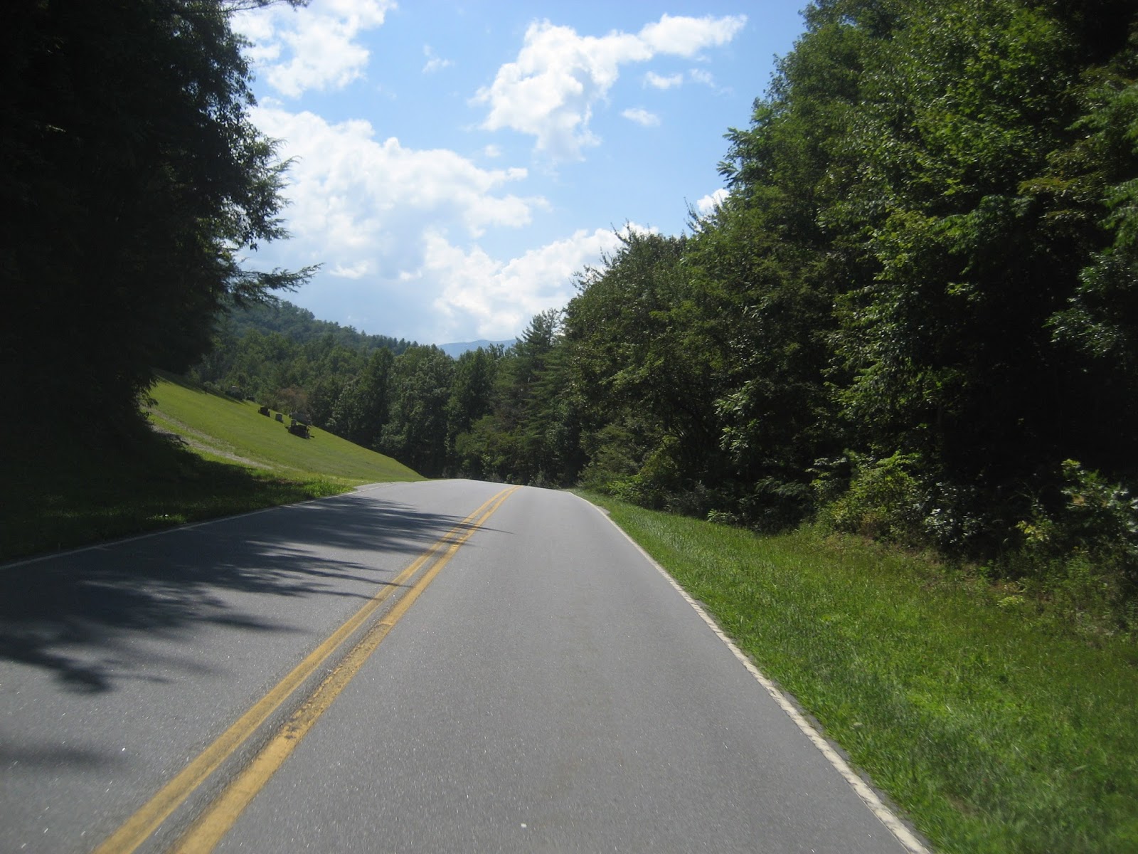
 About half way up Boyds Creek Hwy.

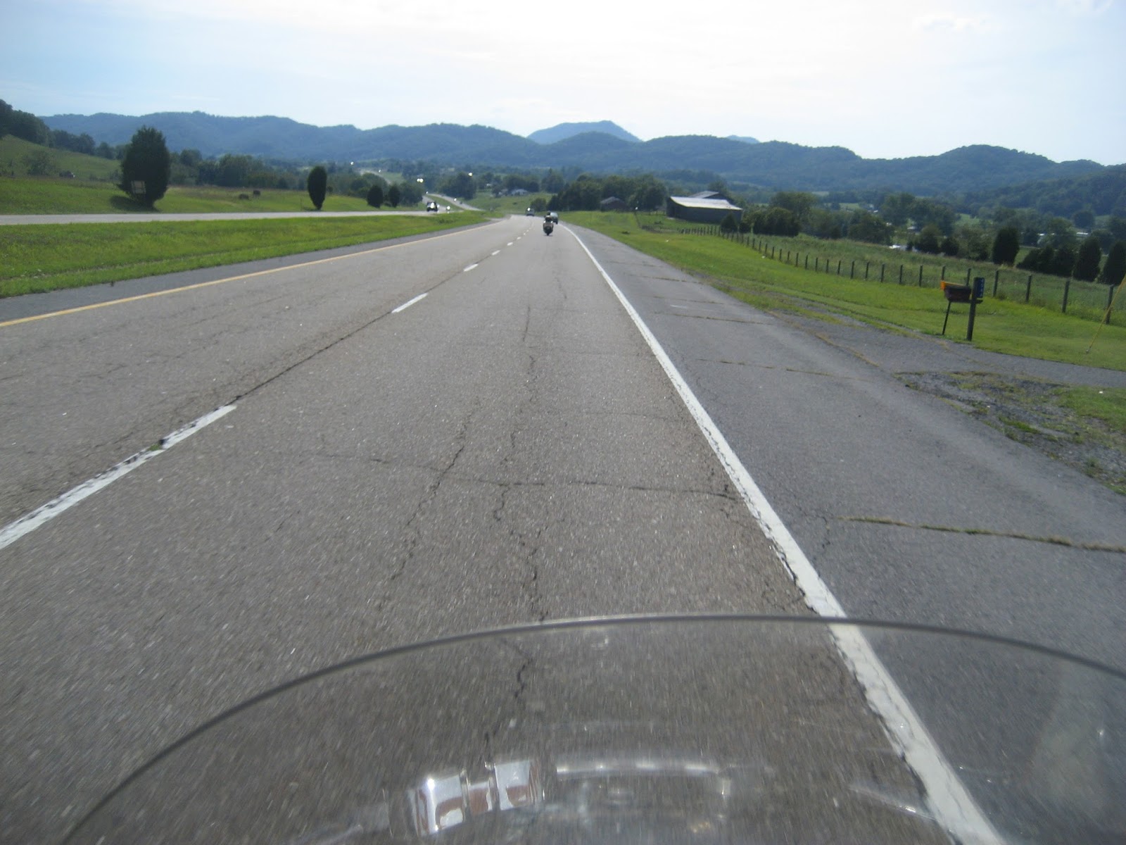
 We were riding US 411 toward Newport, TN and after you clear Sevierville it turns from 4-lanes to 2-lanes making it a more enjoyable ride. The mountains off in the distance were well silhouetted with the brightness of the horizon.

 The mounts are getting closer now as we make our way to our first stopping point. The air is starting to warm up so it won't be long before we start shedding some gear.


 After a little while we came upon another bike riding double. He apparently wasn't from this area as he was traveling very slow. So slow that we pulled off the highway and waited a spell for them to get farther down the road.


 Just outside of Robbinsville, NC is where we stopped to make a decision, ride the Dragon or ride the Cherohala. Since Dave had not ridden the Chrohala Skyway, we elected to take it. Just added a few more miles to the ride and it was such a pretty day. Why resist the opportunity.


